Published September 10, 2026 03:19AM
10 Great U.S. Ridge Traverses, Ranked by Difficulty
A Colorado climber picks the most classic ridge routes in the continental U.S., from California to Maine—and shares the beta for each.

The first of many rappels on the Cirque of the Towers Traverse, with Wolf's Head in the background. (Photo: Brian Stevens Collection)
As a climber, it’s nearly impossible to see a stark, jagged ridgeline cutting across the sky and not want to climb it. There’s something irresistible about traversing from end to end with exposure falling away on both sides. You feel like you’re walking a tightrope through the sky.
Countless ridges throughout the country offer that unparalleled feeling of exposure and completion, but my goal here isn’t to identify the 10 purest ridge traverses in America—or even necessarily the 10 unequivocal best. It’s to explore what a traverse can mean across the wildly different mountain ranges of the United States in the Lower 48.
Some of these routes follow a perfect spine of rock. Others are enormous, somewhat contrived link-ups connecting dozens of summits. Some demand sustained fifth-class climbing, rappelling, glacier travel, and complicated route-finding. A few require little more than scrambling ability, strong legs, and a willingness to spend an awfully long time above treeline. One can be finished before lunch. Another may take the better part of a week.
What they share is the basic appeal of the traverse: Get up high, pick a direction, and keep following the mountains.
ADVERTISEMENT
I’ve arranged these ridge traverses roughly from the biggest, baddest, and most committing to the most approachable. Comparing them is imperfect—is 35 miles of scrambling harder than 10 miles of technical climbing? That’s part of the fun. Taken together, these 10 routes cover just about every way you can travel across a mountain skyline.
1. Pickets Traverse in the North Cascades, Washington
Mileage: ~50–65 miles
Elevation gain: 20,000+ ft gain
Grade/terrain: Up to fifth-class terrain, snow, glaciers, and scrambling
Rope recommended? Yes, for rappelling and any fifth-class sections you don’t want to free solo.
Estimated time: Multi-day (up to ~8 days)
The Pickets are the wild card on this list, in part because there isn’t really one definitive “Pickets Traverse.” Instead, there are various ways of connecting Washington’s Northern and Southern Pickets through what is arguably the most rugged mountain terrain in the Lower 48.
Jagged summits rise above hanging glaciers and absurdly steep, brush-choked valleys. Simply getting through the range can be as difficult as climbing the peaks. Depending on the line, a traverse may combine glacier travel, steep snow, exposed third- and fourth-class scrambling, fifth-class rock, rappels, bushwhacking, and complicated route-finding. Most of the mileage is off trail.
ADVERTISEMENT
The Pickets aren’t about simply following an obvious skyline. Deep glacial cirques, cliff bands, moats, snowfields, and improbable weaknesses constantly interrupt progress. Conditions matter enormously: snow can cover horrible loose rock and speed travel, while simultaneously creating snow bridges, moats, and endless transitions between snow and rock.
More than anything else here, the Pickets feel like an expedition. Strong climbers can still find themselves logging 10- to 16-hour days while carrying overnight gear, and getting “picketed” by weather, route-finding, or unexpectedly slow terrain.
Harder individual climbs and longer endurance objectives exist in the Lower 48. But few routes combine this much remoteness, technical variety, uncertainty, and sheer mountain savagery.
2. Grand Traverse in the Teton Range, Wyoming
Mileage: ~20 miles
Elevation gain: ~12,000 ft.
Grade/terrain: Up to 5.8 climbing, lingering snowpack/ice, loose rock
Rope recommended? Yes.
Estimated time: One very big day to two days
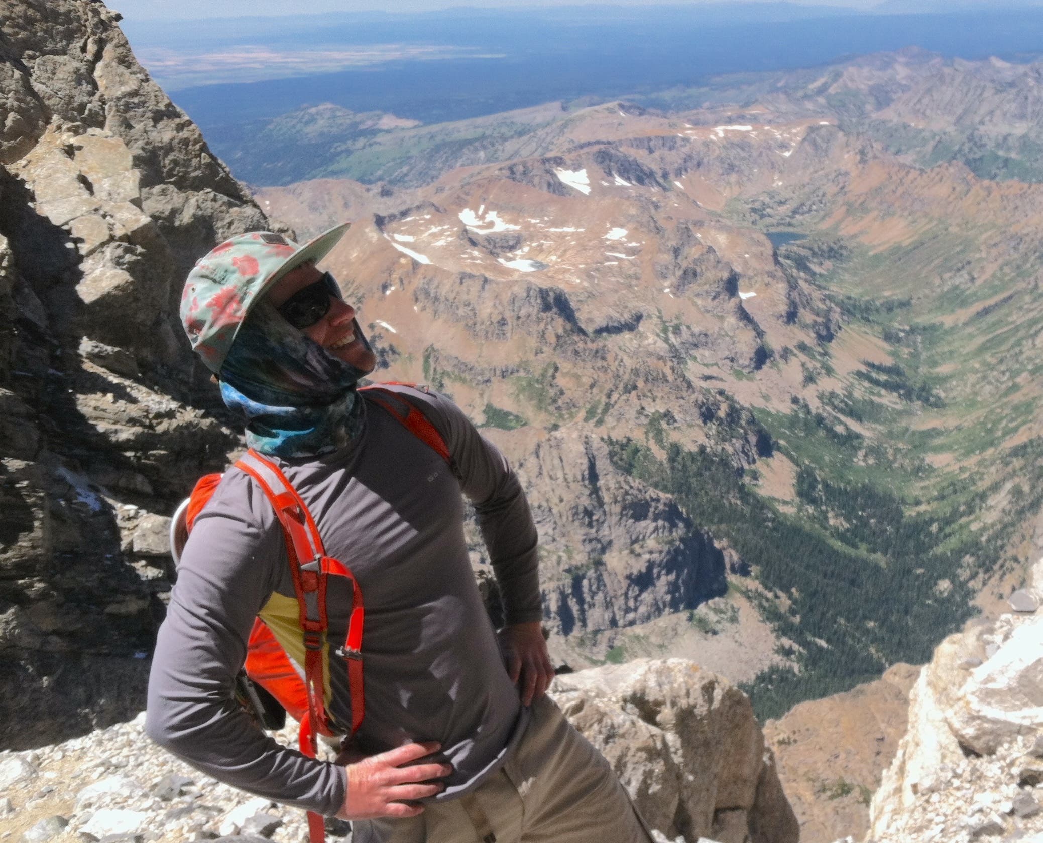
Stretching across the skyline of Wyoming’s Teton Range, the Grand Traverse links Teewinot, Mount Owen, the Grand Teton, Middle Teton, South Teton, Cloudveil Dome, Nez Perce, and a collection of smaller towers along the way.
ADVERTISEMENT
The technical crux is only around 5.8, on the North Ridge of the Grand, but that number badly undersells the undertaking. This is rugged alpine terrain, with loose rock, exposed scrambling and downclimbing, rappels, tricky route-finding, and potentially lingering snow and ice in the high cols.
Efficient parties spend much of the traverse moving unroped, only pulling out the rope selectively. Competent climbers can do much of the Grand Traverse in approach shoes, although climbing shoes are hardly overkill. A route-finding mistake can quickly put you onto considerably harder terrain, and 5.8 feels different above 12,000 feet with a rope, water, and heavy daypack.
I got my first taste of the Tetons in 2015, when I soloed the Grand Teton in a day via the Owen-Spalding. At 5.4, the climbing itself wasn’t particularly difficult, but the day gave me a glimpse of what makes moving quickly through the Tetons so engaging: huge approaches, complicated terrain, exposed scrambling, and an enormous amount of mountain packed into a single outing. I haven’t yet done the full Grand Traverse, but that day had exactly the intended effect. Rather than checking the Grand off the list, I left wanting to come back and connect the entire skyline.
3. Evolution Traverse in the Sierra Nevada, California
Mileage: ~8 miles of ridgeline, plus roughly 26 miles of hiking
Elevation gain: ~15,000-16,000 ft.
Grade/terrain: Up to 5.9, with multiple ~5.6–5.7 sections, alpine choss
Rope recommended? Yes
Estimated time: One huge day to 2-3 days
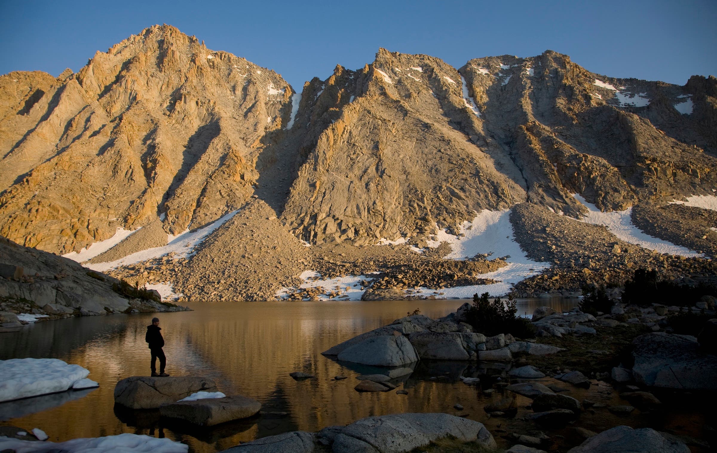
The Evolution Traverse may not be the biggest Sierra ridge traverse, but it’s certainly one of the best. The route follows roughly eight miles of ridgeline across nine 13,000-foot summits high above Evolution Basin, staying on or near the skyline most of the time.
Much of the terrain is second- and third-class scrambling and hiking, but it’s punctuated by substantial fourth class, multiple fifth-class sections, and an intricate skyline of towers, gendarmes (aka, freestanding pinnacles), and knife-edges. The route carries a 5.9 rating, although parties with a rope commonly rappel the hardest downclimbs, leaving most of the actual climbing around 5.6 to 5.7.
ADVERTISEMENT
Soloing is another matter. Route-finding isn’t always obvious, and getting off the easiest line can quickly put you on harder and much more consequential terrain. Despite Evolution’s reputation for Sierra granite, don’t mistake it for eight miles of immaculate rock. There’s plenty of loose alpine terrain mixed in.
The real difficulty, though, is the scale. The approach alone involves roughly 10 miles over Lamarck Col. A complete car-to-car outing can rack up 15,000-16,000 feet of elevation gain. Fast soloists have done it in a day; many parties take two or three.
Early in the traverse, looking toward Mt. Huxley in the distance can make the remaining ridge seem absurdly long. Better not to think about it. Just keep moving one peak at a time until eventually you’re standing on the final summit looking back across eight miles of Sierra skyline.
4. Cirque of the Towers Traverse in the Wind River Range, Wyoming
Mileage: 20+ miles
Elevation gain: 10,000+ ft.
Grade/terrain: Mostly 5.6-5.8 on surprisingly good granite
Rope recommended? Yes
Estimated time: One long day to 2-3 days
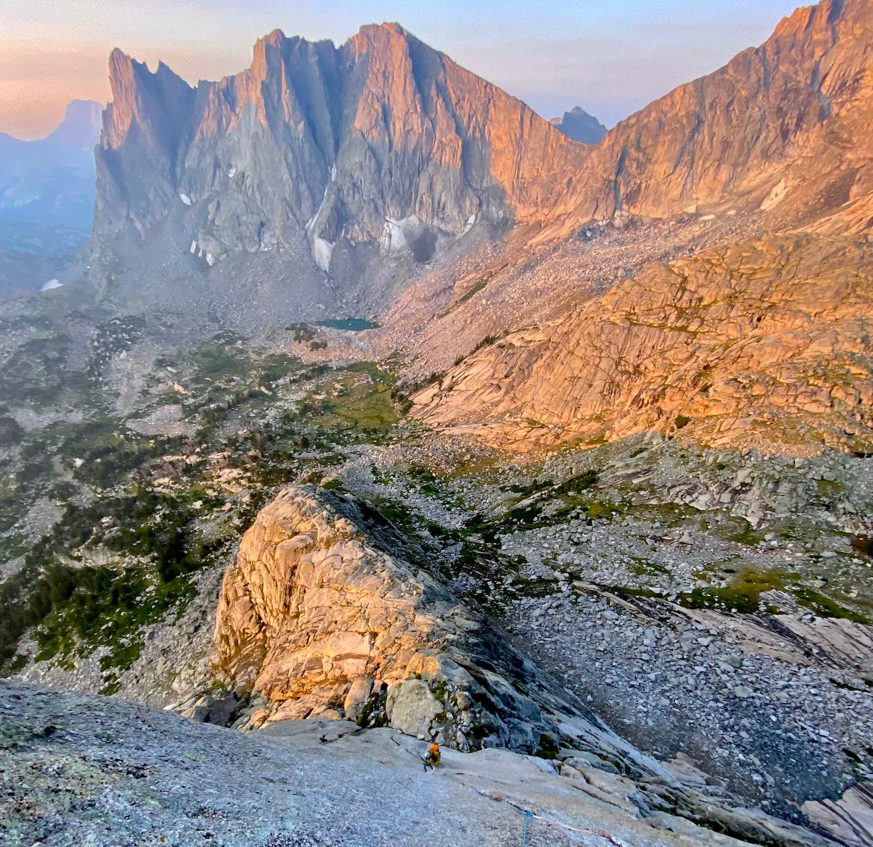
The Cirque of the Towers Traverse is an alpine greatest-hits album. The route links roughly a dozen major summits around one of the most spectacular cirques in the Wind River Range, including Pingora and the East Ridge of Wolf’s Head, before continuing across the towers ringing the basin.
What separates it from many alpine traverses is the rock. Much of the route consists of sustained technical climbing on remarkably good granite. If the rock suddenly becomes terrible, there’s a decent chance you’ve wandered off route.
ADVERTISEMENT
The technical sections generally stay around 5.6 to 5.8, depending on variations, but the exposure, route-finding, rappels, weather, and length make it considerably more serious than the grade suggests. Efficient parties mix soloing and simul-climbing with occasional pitched climbing. Even soloists generally carry a rope for the numerous rappels. Trail runners and climbing shoes are an ideal combination.
Yet compared with something like the Grand Traverse, the Cirque could be considered more civilized. Much of the approach and exit is on a fast trail, the technical climbing is generally excellent, and distinct towers give the route a natural rhythm.
I managed to complete the Cirque Traverse in 15.5 hours tent-to-tent, proving that even a sport climber can survive an alpine outing. For those moving at a more leisurely pace, bivy sites throughout the cirque make stretching the traverse over multiple days hardly a punishment. However, water becomes scarce once you leave the cirque and gain the ridgeline, so plan accordingly.
5. LA Freeway in the Front Range, Colorado
Mileage: ~38 miles
Elevation gain: ~21,000 ft.
Grade/terrain: Up to fifth class scrambling, but mostly class 2-3 climbing and short fourth/low-fifth sections
Rope recommended? No
Estimated time: One enormous push to multi-day
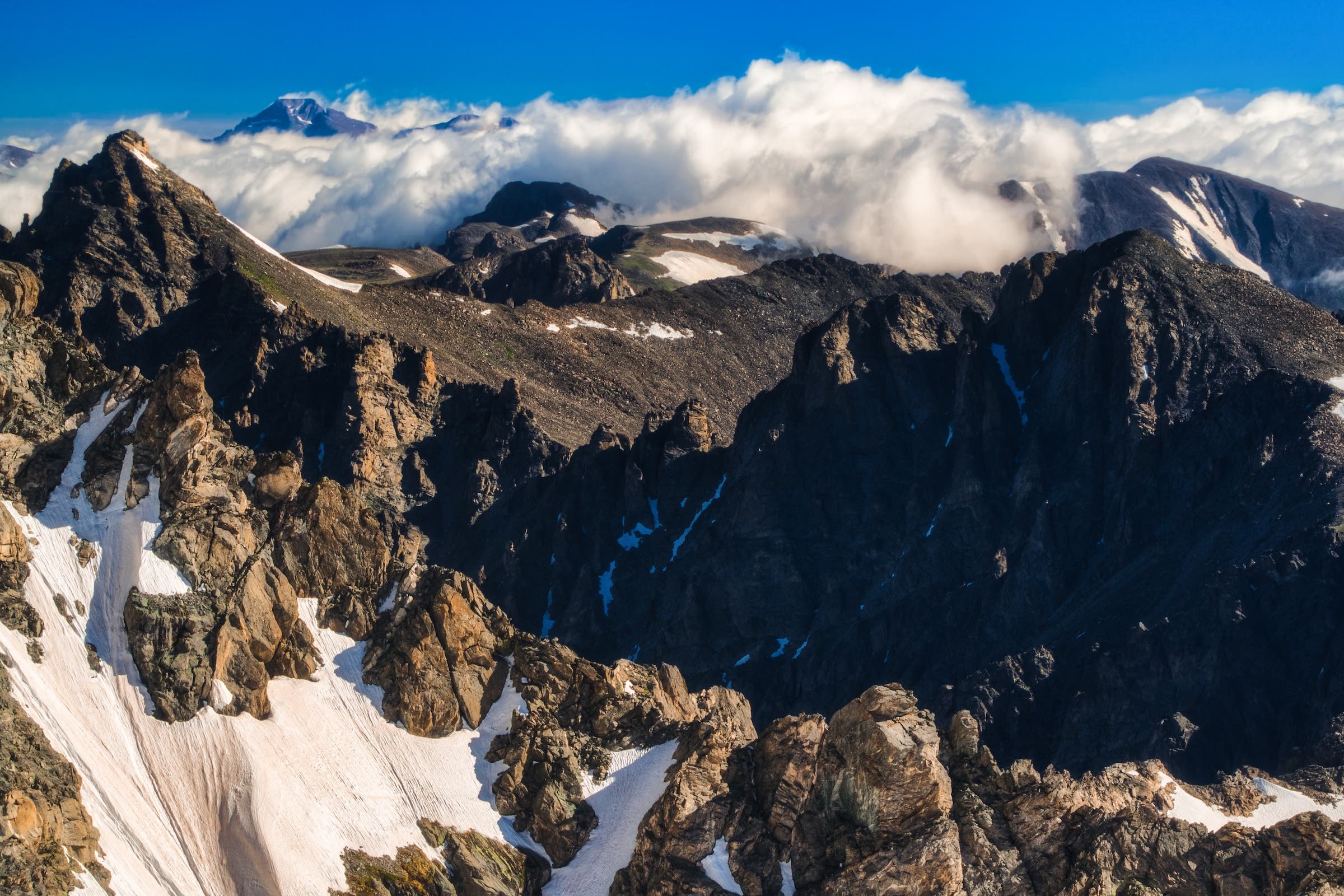
The LA Freeway—short for Longs-to-Arapaho—is less a single ridge than an audacious attempt to stay on the roof of Colorado’s Front Range for as long as possible.
ADVERTISEMENT
Beginning on 14,259-foot Longs Peak in Rocky Mountain National Park, the route follows the Continental Divide south for roughly 38 miles and 21,000 feet of elevation gain before reaching South Arapaho Peak in the Indian Peaks. Along the way, it crosses more than 20 summits and high points.
Despite those numbers, this is much more mountain running and scrambling than technical climbing. Most of the terrain is second and third class. Tundra, talus, and long stretches of runnable ridgeline intermix with a handful of fourth- and low-fifth-class cruxes.
That makes the numbers themselves the crux. Water is scarce through long sections of the Divide, weather can be unforgiving, and what begins as easy scrambling becomes taxing after so many hours on your feet. Later-season parties may cache water at accessible passes; early-season snow can provide water, while adding its own complications.
LA Freeway may be the purest marriage of ridge traverse and mountain ultramarathon on this list: technically modest by alpine-climbing standards, but absolutely enormous.
ADVERTISEMENT
I’ve climbed Longs Peak via the Diamond, done the Arapaho Traverse that forms the tail end of the LA Freeway, and romped around plenty of the terrain in between. In other words, I’ve sampled enough pieces of the route to know that linking all of them together sounds completely unreasonable. 38 miles and 21,000 feet of gain might be too big of a day in the mountains for me—or my willingness—to suffer.
6. Wasatch Ultimate Ridge Linkup (WURL) in Utah
Mileage: ~34-36 miles
Elevation gain: ~18,000-22,000 ft.
Grade/terrain: Mostly scrambling with fourth/low-fifth class
Rope recommended? No.
Estimated time: One enormous push to multi-day
The WURL circumnavigates Little Cottonwood Canyon outside Salt Lake City, linking more than 20 peaks and high points in one giant horseshoe of ridgeline.
Most of it is hiking, boulder-hopping, scrambling, and whatever jogging your legs can handle. But there are also exposed fourth-class sections and pockets of low-fifth-class terrain where a simple mistake can carry enormous consequences.
The difficulty comes from stacking all of that together. Long sections are completely off trail, and route-finding through talus, blocks, cliff bands, and exposed ridges becomes progressively more difficult as fatigue accumulates. Devil’s Castle provides exposed scrambling (where a recent fatality occurred), White Baldy piles on loose boulder-hopping, and the final stretch toward Lone Peak arrives when most people are already thoroughly cooked.
Strong parties complete the WURL in a single massive push, sometimes with friends meeting them at accessible passes with water and food. Others break it into sections first to learn the route.
ADVERTISEMENT
It doesn’t have the sustained fifth-class climbing of Evolution or the Cirque—it doesn’t need it. With more than 20,000 feet of climbing packed into a car-to-car effort, the WURL is a climber-who-runs objective—or a runner-who-is-genuinely-comfortable-scrambling mission—and one of the great American ridge-running sufferfests.
7. Thunderbolt-to-Sill Traverse in the Sierra Nevada, California
Mileage: ~22 miles total
Elevation gain: ~7,500–8,000 ft
Grade/terrain: Mostly 5 fourteeners | fourth-class terrain, with climbing from 5.2-5.6 plus an optional 5.9 summit block; snow
Rope recommended? Yes
Estimated time: Major single-day objective
Thunderbolt-to-Sill is perhaps the quintessential Sierra alpine traverse: five fourteeners connected by a wonderfully improbable-looking skyline of granite.
Traveling north to south, the standard line tags Thunderbolt Peak, Starlight Peak, North Palisade, Polemonium Peak, and Mount Sil. This traverse involves seemingly endless scrambling, exposed downclimbing, and short sections of fifth-class climbing between them.
The nominal 5.9 rating comes largely from Thunderbolt’s tiny and wildly exposed summit block. The famous pitch guarding the top of Mt. Starlight, Milk Bottle goes around 5.4 with a few 5.9 moves. But much of the ridge involves fourth class and climbing in roughly the 5.2 to 5.6 range.
That distinction matters because Thunderbolt-to-Sill is generally climbed more like a very long alpine scramble than a conventional multi-pitch route. Strong parties solo much of the ridge, belay selected cruxes, and carry a light rope for rappels. Moving efficiently on exposed fourth- and easy fifth-class makes an enormous difference in how long this traverse will take you.
ADVERTISEMENT
By the time you reach Sill, you’ve stood atop one-third of California’s fourteeners in a single traverse.
It’s also an excellent introduction to bigger Sierra objectives. Evolution is longer and more sprawling, while the Full Palisade Traverse turns the same concept into something considerably more serious. Thunderbolt-to-Sill hits a sweet spot: technical enough to require real alpine climbing competence, but compact enough for efficient climbers to tackle in a day.
8. Presidential Traverse in the White Mountains, New Hampshire
Mileage: ~20–23 miles
Elevation gain: ~9,000–10,000 ft.
Grade/terrain: Hiking
Rope recommended? No
Estimated time: One big day to 2-3 days
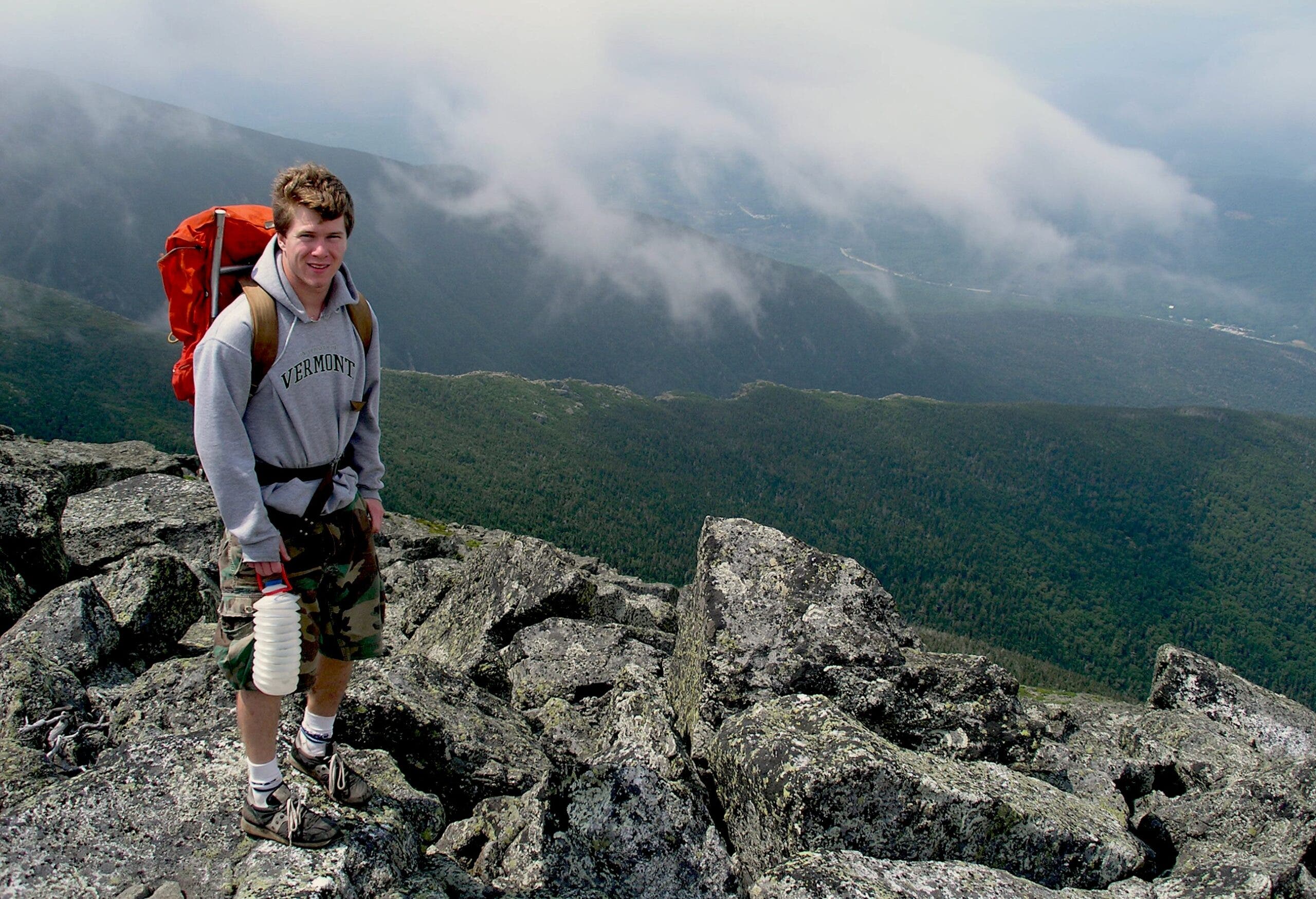
The Presidential Traverse is the East Coast’s answer to a big endurance link-up.
The classic traverse follows the high spine of New Hampshire’s Presidential Range, crossing Madison, Adams, Jefferson, Washington, Monroe, Eisenhower, and Pierce. Depending on exactly which summits and side peaks you include, you’ll cover roughly 20-plus miles and around 9,000 to 10,000 feet of climbing.
ADVERTISEMENT
Technically, the Presidential Traverse is easier than almost every other traverse on this list. There’s no fifth-class climbing, no rappelling, and no reason to carry a rope. Instead, the challenge comes from relentlessly rocky footing, repeated climbing and descending between summits, and long hours above treeline.
Then there’s the weather.
The Presidentials are notorious for high winds, fog, cold, and rapidly changing conditions. Mount Washington sits in the middle of the traverse like a giant weather machine. A pleasant summer hike can acquire an alpine feel remarkably quickly.
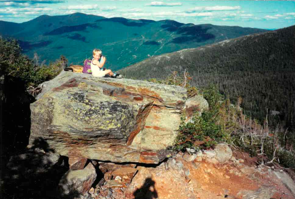
The Appalachian Mountain Club hut system adds a uniquely New England element, providing opportunities for food, water, shelter, or an overnight stop. That makes the Presidential Traverse equally viable as a monster single-day hike or a much more civilized multi-day journey.
No technical climbing required—just strong legs, mountain judgment, and an appreciation for some of the roughest hiking terrain in the East.
ADVERTISEMENT
My history with the Presidentials goes back to the early 1990s, when my dad first took me hiking up Mount Washington at around five years old. I returned in the late ’90s and early 2000s to ski Tuckerman Ravine, and since then I’ve stood on many of the range’s summits and covered large chunks of the Presidential Traverse. I’ve never connected the whole thing in a single push. After more than three decades of returning to these mountains, there’s still an obvious line left unfinished.
9. Matthes Crest in Yosemite in the Sierra Nevada, California
Mileage: ~12 miles of hiking, ~0.5–0.8 miles of climbing
Elevation gain: ~2,300 ft
Grade/terrain: Mostly easy fifth class with a ~5.7 crux
Rope recommended? Yes
Estimated time: Half to full day
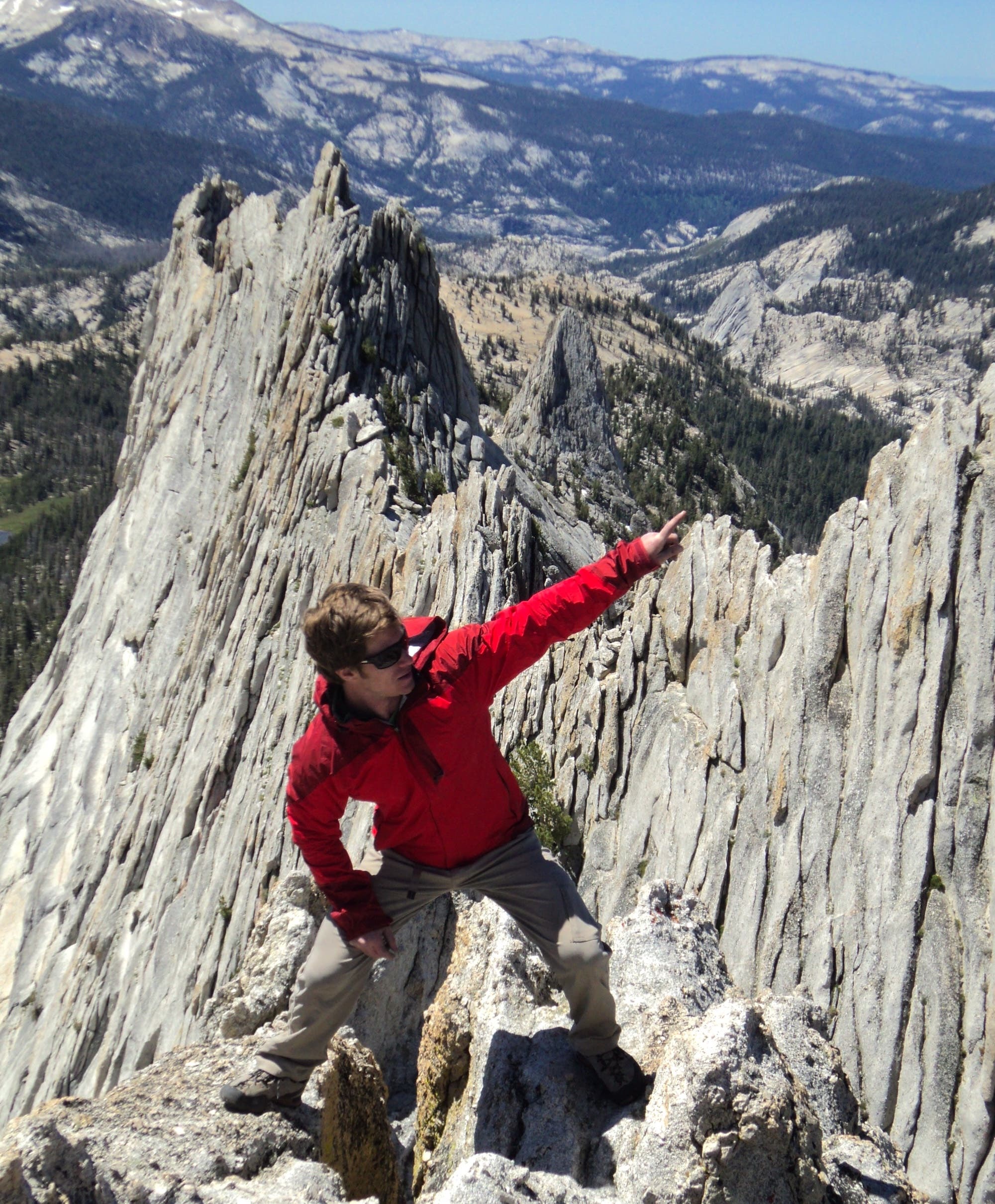
Rising above Tuolumne Meadows in Yosemite National Park, Matthes Crest might be the best ridge traverse in the U.S.
It looks almost too perfect: a long, narrow blade of Sierra granite slicing across the skyline. The standard south-to-north traverse involves mostly easy fifth-class climbing. The greatest difficulties hover around 5.7, with most being long stretches of wonderfully exposed but moderate granite.
Unlike the giant endurance outings above, Matthes is refreshingly simple. Hike in, gain the ridge, and follow it. Most parties climb roughly half a mile to the North Summit and rappel, although continuing farther north adds technical difficulty and extends the experience.
ADVERTISEMENT
Experienced parties commonly simul-climb or move unroped across easier sections, and the combination of excellent rock, modest technical difficulty, easy navigation, and spectacular exposure makes Matthes one of the best introductions anywhere to technical ridge traversing.
Naturally, you can make it much bigger. Linking the Northwest Buttress of Tenaya Peak, Matthes Crest, and the Southeast Buttress of Cathedral Peak creates the Tuolumne “Triple Crown,” turning a relatively manageable ridge climb into a huge tour of Sierra granite.
But Matthes doesn’t need the embellishment. Sometimes the obvious line really is the best one.
ADVERTISEMENT
I climbed Matthes in 2013 with my partner Brandon, soloing most of the crest before we roped up for the 5.7 crux and eventually rappelled from the North Summit. More than a decade later, it remains one of those routes I can’t quite believe is real: mile after mile of Sierra scenery with a perfect ribbon of granite beneath your feet. We did what most parties do and called it at the North Summit, but I’ve wanted to go back ever since—first to finish the entire crest and maybe try to link it with Tenaya and Cathedral for the full Triple Crown.
10. Katahdin Knife Edge in Maine
Mileage: ~1 mile of ridgeline, ~9-10 miles for the classic loop
Elevation gain: ~4,000 ft
Grade/terrain: Full-body scrambling over low-fifth-class terrain, but mostly exposed hiking
Rope recommended? No
Estimated time: Half to full day
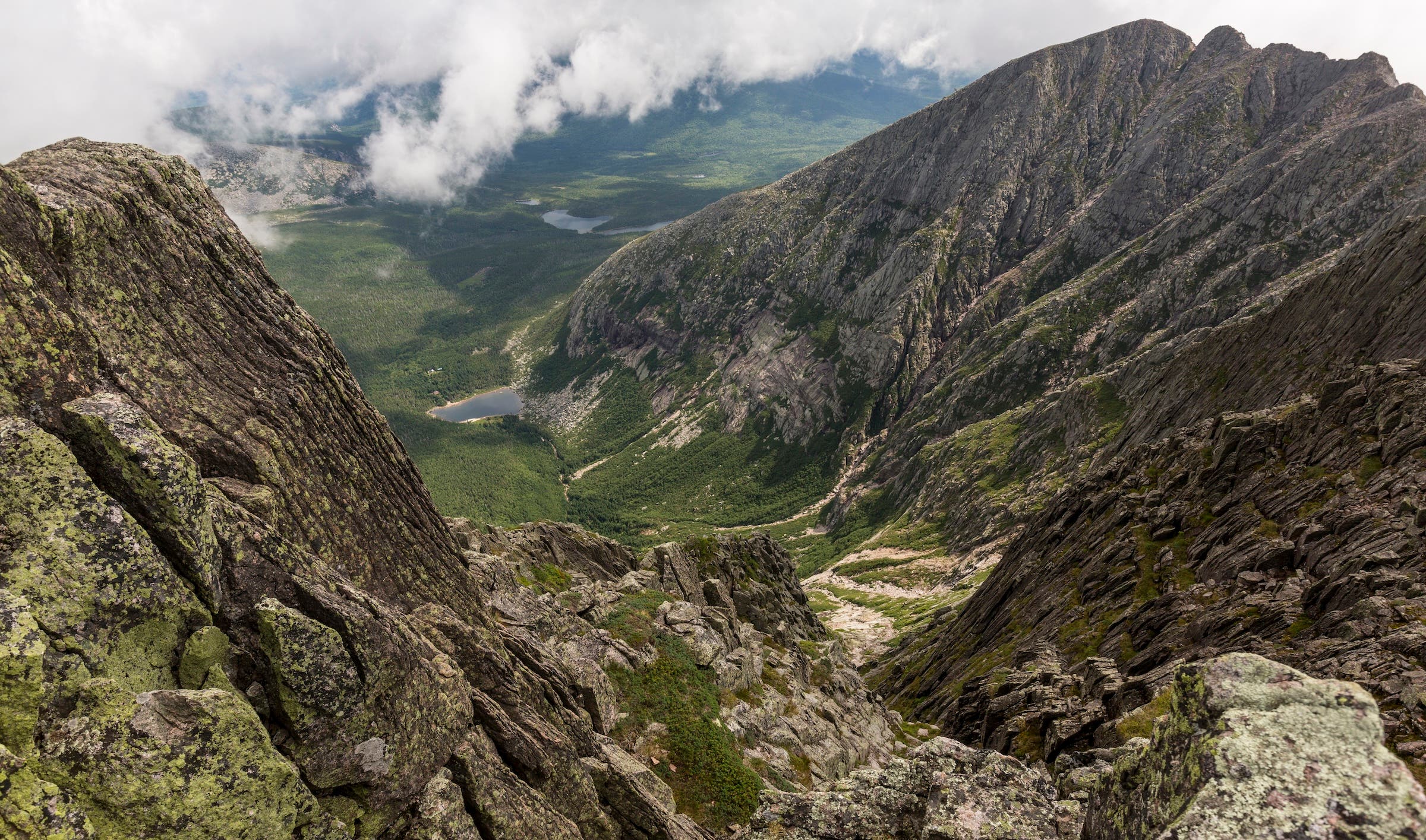
The Knife Edge on Katahdin is a completely different animal from the western traverses on this list—and that’s exactly why it belongs here.
There are no 14,000-foot summits, glacier crossings, or miles of fifth-class climbing. Instead, the route packs an extraordinary amount of exposure into roughly a mile of jagged Appalachian ridgeline connecting Pamola Peak with Baxter Peak, the 5,268-foot summit of Katahdin.
ADVERTISEMENT
The crux comes almost immediately. From Pamola, the ridge plunges steeply into the notch below Chimney Peak before climbing back out, requiring genuine hands-and-feet scrambling. After that, the technical difficulty eases, but the exposure doesn’t. The crest narrows to only a few feet in places, with Katahdin’s enormous glacial basins dropping away below.
For an experienced climber, the movement is modest. For a hiker without a climbing background, it can feel enormous. That makes Knife Edge an unusually good introduction to what exposure and commitment actually feel like without requiring technical rock-climbing skills.
Weather still matters enormously. Wind, rain, lightning, or wet rock can turn straightforward scrambling into something much more serious. Once on the crest, few speedy escape options exist.
The classic outing climbs from Roaring Brook to Pamola, crosses Knife Edge to Baxter Peak, and descends toward Chimney Pond. This makes for roughly a nine or 10-mile day, depending on the variation.
ADVERTISEMENT
What earns Katahdin a place here isn’t scale or technical difficulty. It’s the setting. The mountain rises almost alone above the forests and lakes of northern Maine, while the Knife Edge traces the improbable rim of its enormous glacial basin. You’re simply on top of Maine, walking a knife-thin ridge through the sky.
And for someone looking at the other nine traverses on this list and thinking, I want to start doing this stuff, that might be exactly the place to begin.
Note: Climbing and traversing ridges in the alpine are inherently dangerous activities. The advice, estimated time, and recommendations on carrying a rope for each ridge traverse should be evaluated based on your personal skills and abilities before attempting the route. We also recommend getting a local guidebook or a more detailed trip report for any route herein before taking it on. You should also cross-check weather forecasts prior to heading out on any of these traverses to avoid the risk of lightning above treeline.
